
GUT Modeling
-
GUT Objective 1: Overview of the area
The GUT modeling used in this report is for the North Fork Asotin Creek riverscape. North Fork Asotin Creek is located in southeastern Washington. Image Credit: Dave Peckham.

-
GUT Objective 2.1: Qualitative In-Channel Geomorphology

A detailed DEM of the creek site in our GUT model (North Fork Asotin F4) is shown above for the year 2011. In this map image, the creek’s bankfull extent has been outlined in red. Ground surfaces in the DEM layer are mapped with a continuous color ramp from yellow, green, brown, and white; in other words, the lowest parts of the creek are yellow, next highest is green, and so on. The creek has a heterogeneous bed morphology, represented by the darkened portions in the creek where the elevation differs significantly (some examples of these are outlined in red boxes in the example image). Later on, we will use the tiers of the GUT model to more accurately define these depressed/elevated areas.
-
GUT Objective 2.2: Temporal Variability of Morphology at the North Fork Asotin F4 site
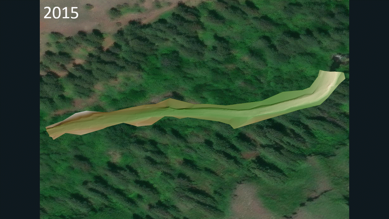
The years chosen for comparison were 2015 and 2017. I chose these years because 2017 is the most recent year with data in our GUT models and using a 2 year period allows for the modeling of the typical bankfull stage flood event (2 year recurrence interval flood) and its associated geomorphological impacts.
-
GUT Objective 2.3: What Tier 2 Forms Are Present Each Year?

Flow direction →

By examining the Tier 2 GUT outputs above, the following can be observed for the creek during 2015-2017: 1) The spatial distribution of in-stream mounds increased, 2) The relative size of the trough units decreased, 3) The creek developed more bowls, and 4) 2 new saddles were formed on the upstream and downstream section of the site's bed, respectively.
-
GUT Objective 2.4: Do any of the Tier 2 Forms dominate the assemblage or is it fairly mixed? Is this true through time?
The creek increased its area of Tier 2 units with convexity during 2015-2017, which replaced some of the planar and concave channel surface area. That being said, it is still largely dominated by concave Tier 2 units (bowls and troughs). In terms of bowls and troughs themselves, 2015 had much less bowls than 2017 and its concave unit area was largely dominated by troughs.
-
GUT Objective 2.5: What Tier 3 Geomorphic Units are present in each year?

Flow direction →

By examining the Tier 3 GUT outputs above, the following can be observed for the creek during 2015-2017: 1) The in-stream geomorphic units are glide-run dominated in 2015 and 2017, but less so in 2017. This is represented in Tier 2 as the replacement of troughs and planes with non-planar Tier 2 units. In Tier 3, this is represented as the 2015-2017 formation of more riffles, pools, and various bars in the channel; and 2) The channel has a less efficient conveyance of water brought by more complexity being added to the channel's hydraulic flow path; specifically, the channel lost its rapid and cascade geomorphic units from 2015-2017.
-
GUT Objective 2.6: Zoom in to 2 to 5 x bankfull width portion of the reach and look at the arrangement of geomorphic units. Is it coherent? Does it make sense based on what you have learned so far?
At about 2x bankfull width, the GUT output is very coherent. Glides and runs have deeper pockets of pools within their extent, and riffles can be seen formed downstream of existing ponds. The creek itself is constrained by banks or margin-attached bars as it flows eastward.


-
GUT Objective 2.7: How well does GUT appear to be doing in each year at discriminating the in channel geomorphic units? Point out any weaknesses or concerns you might have.
GUT seems to work well for most years, except for 2012 which seems to have some data missing like the DEM Hillshade layer. The only ambiguity I'd point out are the transition zones geomorphic unit. I know they represent areas of abrupt change in morphology, but their definition is pretty vague and some years (2015) have a lot of their channel area classified as a 'transition' geomorphic unit.
-
2.7: Identify in one of your surveys for this reach a distinctive pool, bar and planar feature. For all three identify all five attributes from the fluvial taxonomy (i.e., Table 6), then use those to identify the tier 3 name from Table 7 or 8 (this may differ than what GUT output is because it is not as resolved) and explain which attribute(s) were key for discriminating that unit from other units.

2.7A: Pool

2.7B: Bar
2.7C: Planar

-
GUT Objective 2.8: Turn off GUT and look just at the Topo DEM (e.g Detrended DEM and Contours) for one of the surveys. Manually map one geomorphic unit you think you can read in the topography.

-
2.8A - What is the tier 2 Form and the tier 3 shape of the unit you manually identified?
-
Tier 2: Bowl
-
Tier 3 Shape: Concavity
-
-
2.8B - How do the boundaries of the unit you mapped compare with what GUT derived? They're fairly close, but GUT's boundaries are more detailed and position the pool very slightly northwest of where I drew the pool, though they both include the low depression point seen above.
-
2.8C - How does the type you identified compare with what GUT identified? Explain the discrepancies if they exist. No discrepancies exist.
PART 2 FOR NORTH FORK ASOTIN F6
-
GUT Objective 3.1: Qualitatively describe the in-channel geomorphology of this reach.

-
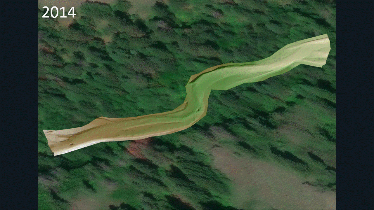
This reach of the North Fork Asotin is located southeast of and further upstream of the first site. It is termed the North Fork Asotin F6 site in our GUT model. The DEM above is from 2014.
-
This site has several pockets, is meandering, and seems to have developed some braiding at its downstream end. The GUT model will provide more details than the DEM image.
-
GUT Objective 3.2: Temporal Variability of Morphology at the North Fork Asotin F4 site
The years chosen for comparison were 2014 and 2016. I chose these years because using a 2 year period allows for the modeling of the typical bankfull stage flood event (2 year recurrence interval flood) and its associated geomorphological impacts.
-
GUT Objective 3.3: What Tier 2 Forms Are Present Each Year?

Flow direction →

By examining the Tier 2 GUT outputs above, the following can be observed for the creek during 2014-2016: 1) The size of saddles in the reach was decreased, 2) It appears a floodplain island was formed (seen above as a non-characterized hole in the Tier 2 layer), 3) The creek developed more plane surfaces, and 4) Overall, the channel appears to be widening and aggrading.
-
GUT Objective 3.4: Do any of the Tier 2 Forms dominate the assemblage or is it fairly mixed? Is this true through time?
The creek increased its channel area from 2014-2016, and created more plane and mound unit form area. In 2014, trough and mound Tier 2 unit forms dominated, while in 2016 they still dominated the reach but their extents/size increased as the channel widened. In other words, the relative assemblage stayed the same but the size of Tier 2 units increased.
-
GUT Objective 3.5: What Tier 3 Geomorphic Units are present in each year?

Flow direction →

By examining the Tier 3 GUT outputs above, the following can be observed for the creek during 2014-2016: 1) The in-stream geomorphic units are glide-run dominated in 2014 and 2016, but less so in 2016. In Tier 3, this is represented as the 2014-2016 formation of more mid-channel bars and margin attached bars; in addition to the formation of a new barface geomorphic unit in 2016 that was non-existent in 2014 and 2) The channel overall widened, developed more bar features, filled some pocket pools, and increased the size of its regular pools or elongated them.
-
GUT Objective 3.6: Zoom in to 2 to 5 x bankfull width portion of the reach and look at the arrangement of geomorphic units. Is it coherent? Does it make sense based on what you have learned so far?
At about 2x bankfull width, the GUT output is very coherent. Glides and runs have pocket pools and deeper regular pools within their extent, and rapids/riffles can be seen formed upstream and downstream of existing ponds. The creek itself is constrained by banks or margin-attached bars as it flows eastward, and also includes mid-channel bars in its extent, some of which have surface area excluded from the Tier 3 Geomorphic Unit output because their heights are so high that they are classified as out-of-channel floodplain islands.

-
GUT Objective 3.7: How well does GUT appear to be doing in each year at discriminating the in channel geomorphic units? Point out any weaknesses or concerns you might have.
GUT seems to work well for most years, except for 2012 and 2015 which seems to have some data missing like the DEM Hillshade layer. The only ambiguity I'd point out again are the transition zones geomorphic unit.
-
3.7: Identify in one of your surveys for this reach a distinctive pool, bar and planar feature. For all three identify all five attributes from the fluvial taxonomy (i.e., Table 6), then use those to identify the tier 3 name from Table 7 or 8 (this may differ than what GUT output is because it is not as resolved) and explain which attribute(s) were key for discriminating that unit from other units.

3.7A: Pool

3.7B: Bar

3.7C: Planar
-
GUT Objective 3.8: Turn off GUT and look just at the Topo DEM (e.g Detrended DEM and Contours) for one of the surveys. Manually map one geomorphic unit you think you can read in the topography.

-
3.8A - What is the tier 2 Form and the tier 3 shape of the unit you manually identified?
-
Tier 2: Mound
-
Tier 3 Shape: Convexity
-
-
3.8B - How do the boundaries of the unit you mapped compare with what GUT derived? Gut made the mid channel bar significantly larger.
-
3.8C - How does the type you identified compare with what GUT identified? No discrepancies exist, but GUT made the bar larger.
Part 3: Differences between F4 & F6
-
3. 1 : What are the primary differences from exploring GUT between these two sites that you noticed between the in channel geomorphic units of these two sites?
-
F6 had more aggradation and convex features.
-
-
3. 2 : What inferences can you make about geomorphic processes and behavior when contrasting GUT outputs between these two sites?
-
It seems unit stream power increased downstream from F6 to F4, since there were less convex features like bar in F4.
-
-
3.3 : If you only had one GUT output from each of these two sites (i.e. one snap shot) how representative would be your inferences about geomorphic processes? If you did not have the luxury of six or seven surveys, but just one, would your conclusions above be different?
-
It would be hard to make any inferences at all if you only had 1 snapshot; since reaches can vary greatly across space and time.
-
Part 4: Synthesis
-
4. 1 : How are the Tier 2 Forms from GUT different than what we discussed in field?
-
In the field, it seemed we focused more on Tier 3 classification to be honest. In general though, GUT tends to be more specific by mapping convex, planar, and concave units in more elongated forms than the general approximations we made in field.
-
-
4. 2 : How are the Tier 3 GUs GUT exports different then the ones we discussed? Why do you think GUT does not output the same things?
-
They are more specific in shape and extent, and may have strange overall polygonal shapes. This is because the output of GUT is derived from advanced algorithms/mathematical calculations.
-
-
4.3 : How would you apply Tier 4? Do you have enough information here to do that?
-
Tier 4 is primarily based on vegetation cover of geomorphic units, so we do not have the information needed for an accurate Tier 4 breakdown.
-
-
4.4 : Does exploring these GUT outputs give you more or less confidence in applying the fluvial taxonomy through manual mapping off of topography versus identification in the field?
-
It gives me confidence in verifying mapping results from the field, and I think if I was an actual practitioner I would perform rough mapping in the field then use GUT outputs to modify what I had actual images of.
-